Lahore Pakistan was jolted with earthquake at local time 2320 hours
Lahore, Pakistan: Lahore Pakistan was jolted with earthquake at local time 2320 hours. Earthquake was felt in north of Pakistan including in Gilgit, Hunza, Skardu, Islamabad, Peshawar, Lahore and other parts of Pakistan. According to initial information, intensity of earthquake was 6.2 on Richter scale.
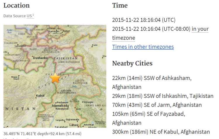
According to According to USGS, the epicentre of earthquake was 22km SSW of Ashkasham, Afghanistan and 29km (18mi) SSW of Ishkashim, Tajikistan. The depth of earthquake was 92.4 km inside earth and intensity was 5.9 on Richter scale. This was second earthquake that was generated from same place in less than one month. Reports are coming from Tajikistan and Afghanistan about destructions in mountain areas as depth of earthquake was less and it was a shallow earthquake. Reports suggested that Chitral valley was again strongly hit by earthquake.

It may be mentioned that 81 thousands houses were destroyed in Khyber Pakhtunkhwa as a result of strong earthquake which jolted various parts of the country on October 26.
As many as 262 people died while more than 1500 people injured only in KPK province while toral number of death was over 340 in the country. As many as 495 schools were destroyed in the earthquake.

Relief activities carried were out by the NDMA, Provincial Disaster Management Authorities (PDMAs), Pakistan Army and other relief agencies are continuing in the earthquake hit areas.
The relief agencies distributed till now 40,846 tents, 45,912 blankets and 27 ton medicine in earthquake hit areas. Rs127,200,000 among heirs of dead in earthquake distributed
Likewise, Rs127,200,000 had been distributed among heirs of 212 dead in Khyber Pakhtunkhwa till Thursday under Prime Minister Compensation Package.
On October 28, Prime Minister Nawaz Sharif during his visit to Peshawar had announced Rs 0.6 million for each dead, Rs100,000 for minor injured and Rs2 lakh for disabled in the earthquake. The prime minister had also announced Rs0.2 million for each owner of completely destroyed houses while Rs100,000 million each for the partially damaged houses.
